Powerful earthquake close to Pangai island, Tonga

Downtown Pangai, Lifuka, Ha'apai, Tonga

Pangai Tonga - Image via Wikipedia

Earthquake Report comment :
Very powerful earthquake with epicenter about 30 km from the island of Lifuku,  Pangai. The last couple of days multiple earthquakes occurred in the same area.
Epicenter on the upper slopes of the subduction zone!
Maximum expected shaking V to VI Mercalli = moderate shaking
No Tsunami Bulletins have been issued at this time by NOAA.

Most important Earthquake Data:
Magnitude : M 6.0 (Preliminary)
Thursday, November 04, 2010 at 12:34:44 PM at epicenter
Depth (Hypocenter) : 33.2 km
Send an “earthquake experience report” for this earthquake
http://www.emsc-csem.org/Earthquake/Contribute/testimonies.php?lang=en&id=196
Geo-location(s) :
30 km south east of Pangai
120 km (75 miles) NE of NUKU`ALOFA, Tonga

Links to important maps
USGS Did You Feel It Map
Google satellite map of the area showing the kind of terrain the earthquake took place
USGS Shaking map
USGS historic earthquakes map
USGS Pager map
USGS Seismic Hazard Map
GDACS Green Earthquake Alert (Global Disaster Alert and Coordination System)
LIVE SEISMOGRAM (nearest Seismograph station)
GDACS Green Tsunami alert

* GDACS (Global Disaster Alert and Coordination System) provides near real-time alerts about natural disasters around the world. GDACS is a Joint Initiative of the United Nations and the European Commission

QuakeSOS has been developed to help actively people who are caught in an earthquake + delivers "Earthquake Report" information on your iPhoneQuakeSOS is a FREE iPhone application developed by Armand Vervaeck, the creator and main contributor to Earthquake Report. The Application simplifies immediate group communication to friends and family members (with your exact GPS location) and is constantly feeding the users with “Earthquake Report” news. Together with your own family and friends, QuakeSOS will be your closest earthquake friend.

Earthquakes list September 16, 2010

M 3.9      2010/09/16 15:54    Depth 4.6 km     CENTRAL CALIFORNIA
Light earthquake near Sequoia National Forest

M 4.8      2010/09/16 15:36    Depth 42.1 km      CELEBES SEA
Moderate harmless earthquake at a safe distance of the coast.

M 5.1      2010/09/16 15:27    Depth 25.2 km      COSTA RICA

Please also read the detailed page of this earthquake

M 4.6    2010-09-16   07:23   Depth 32 km       ADMIRALTY ISLANDS REGION, Papua New Guinea
Harmless earthquake in the middle of the Bismarck Sea

M 5.5      2010/09/16 01:54    Depth 96.5 km     TONGA
25 km (15 miles) SW of Hihifo, Tonga.  Powerful but weakened by the depth. People living in Hihifo will have experienced a moderate shaking

M 4.7      2010/09/16 01:38    Depth 70.4 km     MINDANAO, PHILIPPINES

In the coastal waters of and near Tandag City, Cortes and Lanuza in the province of Surigao del Sur. Cortes has a population of 14,825.

M 4.9      2010/09/16 00:00    Depth 166.5 km     CORDOBA, ARGENTINA
Moderate earthquake at an safe depth. 140 km from the city of Cordoba

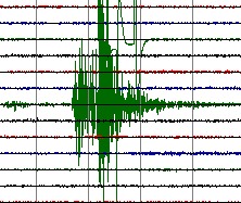
seismograph - recordingUseful information to read this daily earthquake list
This earthquake list covers minor and major earthquakes in the world.
If a more detailed page is present, the earthquake line will be linked to the detailed page.
For your comfort, we will provide in most cases Google Satellite Map links to give you an idea where the earthquake struck, which terrain it happened and if villages or cities are located in the immediate vicinity. The reference for the time zone is UTC (Coordinated Universal Time, also called GMT)
The page is regularly updated to add new earthquakes.
green color = NOT dangerous for damage or injuries
orange color = MODERATE risk for damage or injuries
red color = CONSIDERABLE risk for damage or injuries

QuakeSOS has been developed to help actively people who are caught in an earthquake + delivers "Earthquake Report" information on your iPhoneQuakeSOS is a FREE iPhone application developed by Armand Vervaeck, the creator and main contributor to Earthquake Report. The Application simplifies immediate group communication to friends and family members (with your exact GPS location) and is constantly feeding the users with “Earthquake Report” news. Together with your own family and friends, QuakeSOS will be your closest earthquake friend.

Earthquakes list September 12, 2010

M 4.1      2010/09/12 20:09    Depth 5.0 km     WYOMING, USA
Feeble earthquake in Teton National Forest, 40 km from Jackson. This time in a slightly different area than a couple of weeks ago.

M 5.2      2010/09/12 16:35    Depth 36.8 km      MINDANAO, PHILIPPINES
Location of the epicenter has a big error margin. About 30 km out of the coast.

M 4.7      2010/09/12 14:41    Depth 58.2 km     KURIL ISLANDS
On top of the subduction area near the Kuril Kamchatka trench. Not dangerous

M 4.9      2010/09/12 13:01    Depth 27.9 km     EASTERN KAZAKHSTAN

Moderate earthquake in virgin like nature. Only nomads will have felt this earthquake.

M 5.0      2010/09/12 09:10    Depth 135.1 km     NEW BRITAIN REGION, PAPUA NEW GUINEA
Only 5 km from the beaches of Duke of York Island, and also close to the eastern shores of New Britain Island.  The area is a very complicated tectonic zone wit a lot of subduction zones. Earthquakes with this Magnitude are mostly harmless. The main dangers can come from local tsunamis generated by undersea landslides in the trenches which are clearly visible on this satellite picture

M 5.4      2010/09/12 07:40    Depth 48.9 km     ANDREANOF ISLANDS, ALEUTIAN IS., ALASKA
A very active earthquake area in a distant but beautiful area of Alaska. 50 km from Tanaga Volcano.

M 4.8      2010/09/12 07:05    Depth 34.6 km     SAMOA ISLANDS REGION
One of a number of earthquakes in the same subduction area. Nearest island : Niuatoputapu (Tonga). One of the villages on the island (Falehau) was extensively damaged by a tsunami after a M 8.0 earthquake struck the Samoan Islands area on September 29 2009. Panoramio picture of the shores of Falehau

M 5.3      2010/09/12 06:00    Depth 10.0 km     BALLENY ISLANDS REGION

Epicenter in the Southern Ocean. The 3th moderate earthquake in a couple of days in the same area

M 5.3      2010/09/12 06:00   Depth 10.1 km     SOUTH OF AUSTRALIA
In the Southern Sea, closer to Antarctica then to Australia and New Zealand

M 4.6      2010/09/12 05:25   Depth 199.8 km      NICARAGUA
Deep harmless earthquake on the shores of Lago de Nicaragua, 40 km from Rivas

seismograph - recordingUseful information to read this daily earthquake list
This earthquake list covers minor and major earthquakes in the world.
If a more detailed page is present, the earthquake line will be linked to the detailed page.
For your comfort, we will provide in most cases Google Satellite Map links to give you an idea where the earthquake struck, which terrain it happened and if villages or cities are located in the immediate vicinity. The reference for the time zone is UTC (Coordinated Universal Time, also called GMT)
The page is regularly updated to add new earthquakes.
green color = NOT dangerous for damage or injuries
orange color = MODERATE risk for damage or injuries
red color = CONSIDERABLE risk for damage or injuries

QuakeSOS has been developed to help actively people who are caught in an earthquake + delivers "Earthquake Report" information on your iPhoneQuakeSOS is a FREE iPhone application developed by Armand Vervaeck, the creator and main contributor to Earthquake Report. The Application simplifies immediate group communication to friends and family members (with your exact GPS location) and is constantly feeding the users with “Earthquake Report” news. Together with your own family and friends, QuakeSOS will be your closest earthquake friend.

Earthquakes list August 30, 2010

M 5.3      2010/08/30 23:25   Depth 38.7 km TONGA
Nothing special, but a beautiful satellite view of a bended subduction fault line

M 4.9      2010/08/30 19:55   Depth 80 km KERMADEC ISLANDS, NEW ZEALAND
In the middle of the South Pacific Ocean

M 4.7       2010/08/30 13:40   Depth 220.7 km PAGAN REGION, NORTHERN MARIANA ISLANDS
Very deep in the mantle of the earth. 20 km from the island of Agrihan

M 4.9      2010/08/30 12:57   Depth 10.0 km REYKJANES RIDGE
In the middle of the North Atlantic ocean in between Greenland and Iceland

M 5.0      2010/08/30 12:35   Depth 10.0 km NEW BRITAIN REGION, PAPUA NEW GUINEA
New earthquake in the same area than 12 hours earlier. At a little more distance from Kimbe, but shallower.

M 4.1   2010/08/30 09:57   Depth 2 km POLAND
Relatively strong shallow earthquake for Poland. Near the cities of Jaczow and Ruszowice.

M 4.6      2010/08/30 09:39   Depth 136.0 km MYANMAR
Limited magnitude and deep enough to avoid problems.

M 5.0      2010/08/30 08:45   Depth 12.2 km TAIWAN REGION
A moderate but shallow earthquake near the northern coastal towns.
Click on the this text for a detailed report

M 4.6      2010/08/30 05:15   Depth 189.6 km TONGA
No problem at this depth and Magnitude

Niuafoʻou Island, Tonga, from space

Niuafoʻou Island from space - Image via Wikipedia

M 5.1      2010/08/30 04:44   Depth 10.0 km TONGA ISLANDS
Moderate shallow earthquake at least 100 km away from populated areas. This is the (active)  volcano island of Niuafo’ou, closest to the epicenter. Niuafo’ou is a shield volcano with a crater lake 23 meters above sea level.

M 4.7      2010/08/30 04:25   Depth 27.1 km SHIKOKU, JAPAN
Moderate earthquake in the subduction zone near the island (out in the sea).

M 5.1      2010/08/30 00:39   Depth 33.3 km NEW BRITAIN, PAPUA NEW GUINEA
Only 15 km from Kimbe, with a population of more then 18,000 inhabitants, one of the major cities on the island.
Kimbe is a modern city with concrete buildings, which makes these constructions vulnerable if not build with earthquake proof methods. This explains our orange “moderate risk” label.

Useful information to read this daily earthquake list
This earthquake list covers minor and major earthquakes in the world.
If a more detailed page is present, the earthquake line will be linked to the detailed page.
For your comfort, we will provide in most cases Google Satellite Map links to give you an idea where the earthquake struck, which terrain it happened and if villages or cities are located in the immediate vicinity. The reference for the time zone is UTC (Coordinated Universal Time, also called GMT)
The page is regularly updated to add new earthquakes.
green color = NOT dangerous for damage or injuries
orange color = MODERATE risk for damage or injuries
red color = CONSIDERABLE risk for damage or injuries

QuakeSOS has been developed to help actively people who are caught in an earthquake + delivers "Earthquake Report" information on your iPhoneQuakeSOS is a FREE iPhone application developed by Armand Vervaeck, the creator and main contributor to Earthquake Report. The Application simplifies immediate group communication to friends and family members (with your exact GPS location) and is constantly feeding the users with “Earthquake Report” news. Together with your own family and friends, QuakeSOS will be your closest earthquake friend.

Earthquakes list August 26, 2010

M 5.4      2010/08/26 15:08   Depth 283.5 km     NEAR THE WEST COAST OF HONSHU, JAPAN
Powerful, but too deep to cause any problem. Right under the mainland and 51 km from Fukui. We will publish a detailed report within a couple of minutes.

M 4.7  2010-08-26   13:09   Depth 624 km !     FIJI REGION
Very very deep in the upper mantle of our planet, a dense hot layer of semi-solid rock.

Map of Timor, designed by Boffin

Image via Wikipedia

M 4.7  2010-08-26   09:45   Depth 10 km      TIMOR REGION
Remote coastal area on the island of Timor (West Timor = Indonesian part).  Serious shock because of the shallow depth of the earthquake and the immediate vicinity of a small village. Look at the gravel roads leading to the village and the patchwork of fields from the local people.

M 4.5      2010/08/26 08:02   Depth 124.5 km TONGA
At least 100 km from the nearest populated island

M 5.1      2010/08/26 04:21   Depth 139.2 km     BANDA SEA, INDONESIA
In the middle of the Banda Sea

Useful information to read this daily earthquake list
This earthquake list covers minor and major earthquakes  in the world.
If a more detailed page is present, the earthquake line will be linked to the detailed page.
For your comfort, we will provide in most cases Google Satellite Map links to give you an idea where the earthquake struck, which terrain it happened and if villages or cities are located in the immediate vicinity. The reference for the time zone is UTC (Coordinated Universal Time)
The page is regularly updated to add new quakes.
green color = NOT dangerous for damage or injuries
orange color = MODERATE risk for damage or injuries
red color = CONSIDERABLE risk for damage or injuries

QuakeSOS has been developed to help actively people who are caught in an earthquake + delivers "Earthquake Report" information on your iPhoneQuakeSOS is a FREE  iPhone application developed by Armand Vervaeck, the creator and main contributor to Earthquake Report.  The Application simplifies immediate group communication to friends and family members (with your exact GPS location) and is constantly feeding the users with “Earthquake Report” news. Together with your own family and friends, QuakeSOS will be your closest earthquake friend.

Minor earthquakes are earthquakes without or with little damage risk.  In most cases these earthquakes have a Magnitude smaller than M 5.0 OR earthquakes with an hypocenter (depth) of more than 100 km OR earthquakes up to M 5.9 with an epicenter far away from populated areas.